The mobile phone became a smartphone after it not only served to call and send SMS, but also to do a thousand and one added things. One of them seemed almost magic, but it has ended up becoming something so everyday that we don't even pay attention to it. Why, Do you know how your mobile's GPS works?
How to make GPS work faster and without losing coverage
We show you a simple and practical way to make the GPS of your Android mobile work much better. Don't lose coverage again!
Is open Google Maps, Waze, Pokémon GO… and in seconds we are located on the map precisely and with the option to follow our steps. This technological miracle is the most common, but to achieve it not only need sensors in the mobile, but also an extensive global satellite network. Let's see how it works.
What is GPS and how does it work?
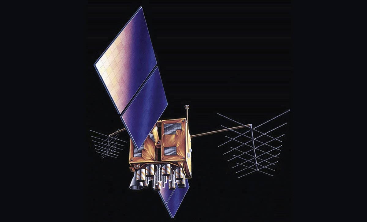
GPS satellite Block IIR. GPS.gov image
GPS is a multi-satellite positioning system which uses receivers placed on the phone to capture the emissions of specific satellites that orbit the Earth. Although we call this system «GPS» in a generic way today, our smartphone connects to different satellite networks, not just GPS itself (Global Positioning System).
Developed by the US military for military use, GPS ended up being enabled for civilians to use. Of course, with much less precision: in general the minimum is in the 4-8 meters of margin (the armies and companies that need an exact positioning geolocate their objectives with millimeters of error).
Galileo, as is the European GPS that improves the positioning of your mobile
Galileo is the European geolocation system, compatible with GPS and GLONASS. bq has launched the first smartphone compatible with l.
Apart from GPS There are other positioning systems. Countries with great military tradition have developed their own system: GLONASS in Russia and Beiou in China (both open for civil use). In addition, Europe has its own positioning system that has not been released for too long: Galileo. These four are the ones that are usually equipped on smartphones: depending on the range of your mobile you will have more or less; always with the GPS as a system default positioning.
GPS.gov image
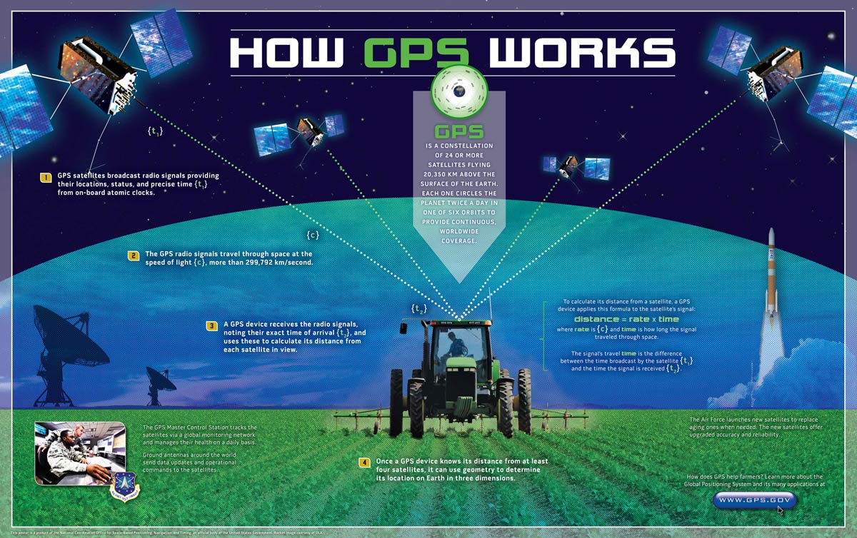
We have already seen that the mobile has sensors that capture the signal emitted by satellites and that they orbit around the Earth. Now: how is it possible that our mobile know exactly where we are just by picking up the signal of devices that are at over 20,000 kilometers away? The key is in mathematics.
- Since the satellite's orbit is to regulate the mobile, it knows exactly where each of these satellites is: its signal is identified with the satellite number and other data, such as its elevation and azimuth (the angle that the satellite signal creates with respect to the surface of the Earth).
- The mobile GPS capture as many signals as possible to position itself reliably. In the process you will see that the precision is reduced in meters until it is stable around 4-16 meters.
- The signal takes a while from leaving the satellite until it reaches the mobile receiver. Since the speed is constant (speed of light, more than 299,792 km / s) the mobile can calculate the precise distance to the satellite.
- When the mobile has at least four satellites captured, it can already be positioned in the three dimensions of the map using trilateration: the mobile draws a circle around each satellite; and the point where all the circumferences intersect will be the precise location.
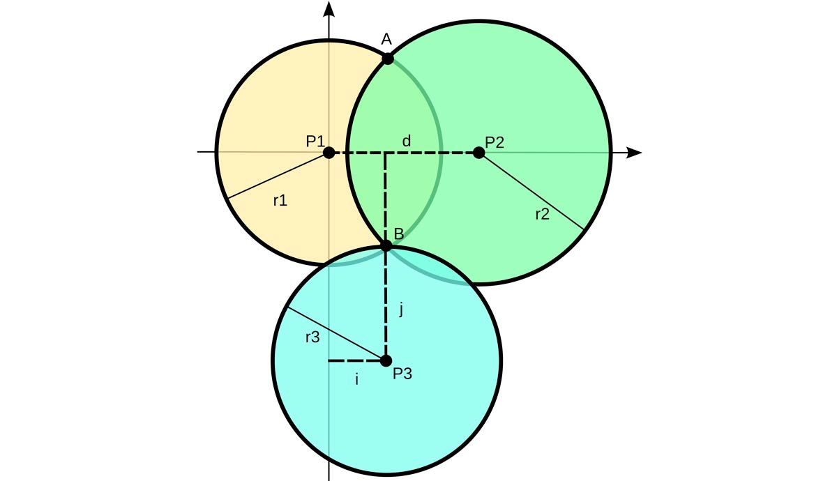
How trilateration positioning is calculated: point B is the position. Wikipedia image
Now imagine that you don't just use satellites GPS (24), your mobile can connect to the system GLONASS (24 satellites), Galileo (30 satellites) and Beiou (35 satellites): the most modern mobiles already incorporate compatibility with these four systems (and with others, such as the Japanese QZSS). This achieves precise positioning in much less time since the mobile can detect a high number of signals using trilateration to mark the position on the map.
So far we have seen how the GPS of your smartphone works and how it is able to obtain precise positioning using satellites that orbit thousands of kilometers. Want to see which satellites capture your phone in real time and other positioning data? We have two apps perfect for it.
GPStest
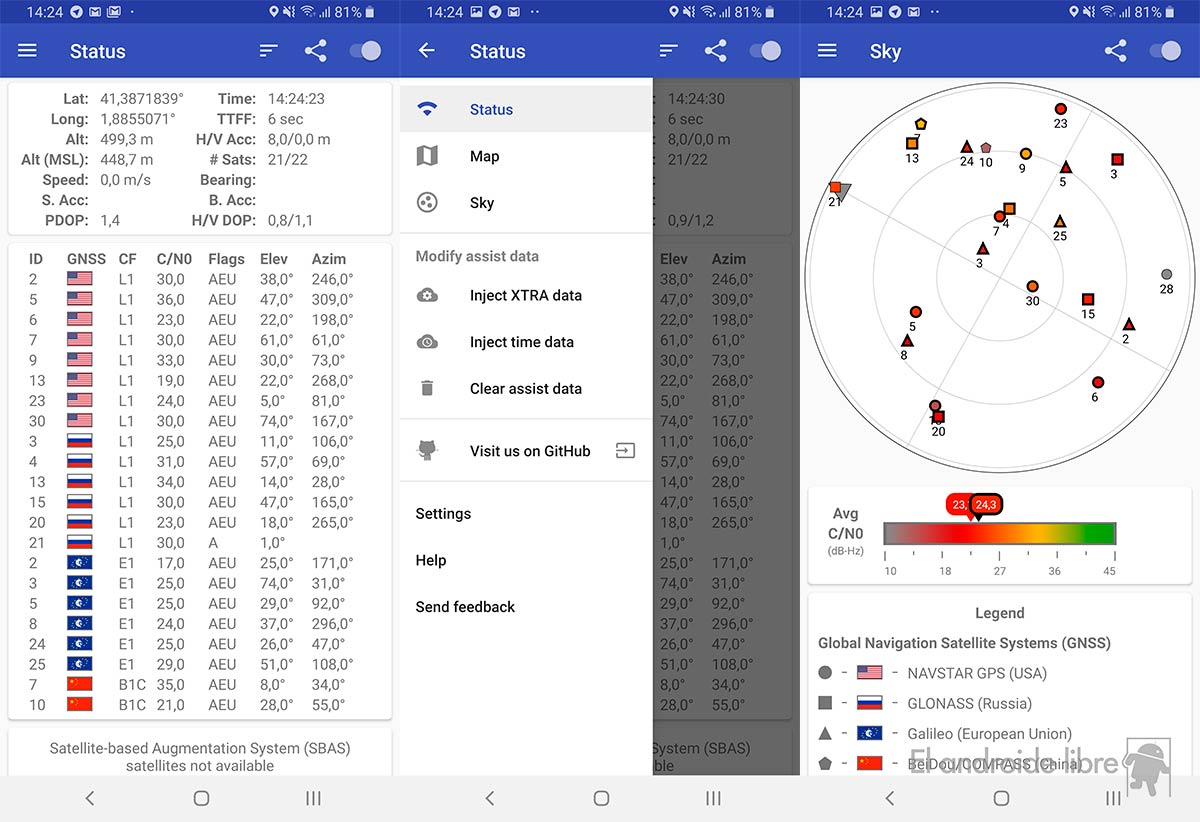
It is our first option: an open source app that shows all the satellites to which the mobile is connected in addition to numerous information; such as the system to which each satellite belongs (identified by the flags), the azimuth, the ID, the elevation … In addition, you can use the built-in map and also see the representation of satellites in the sky.
GPS Test
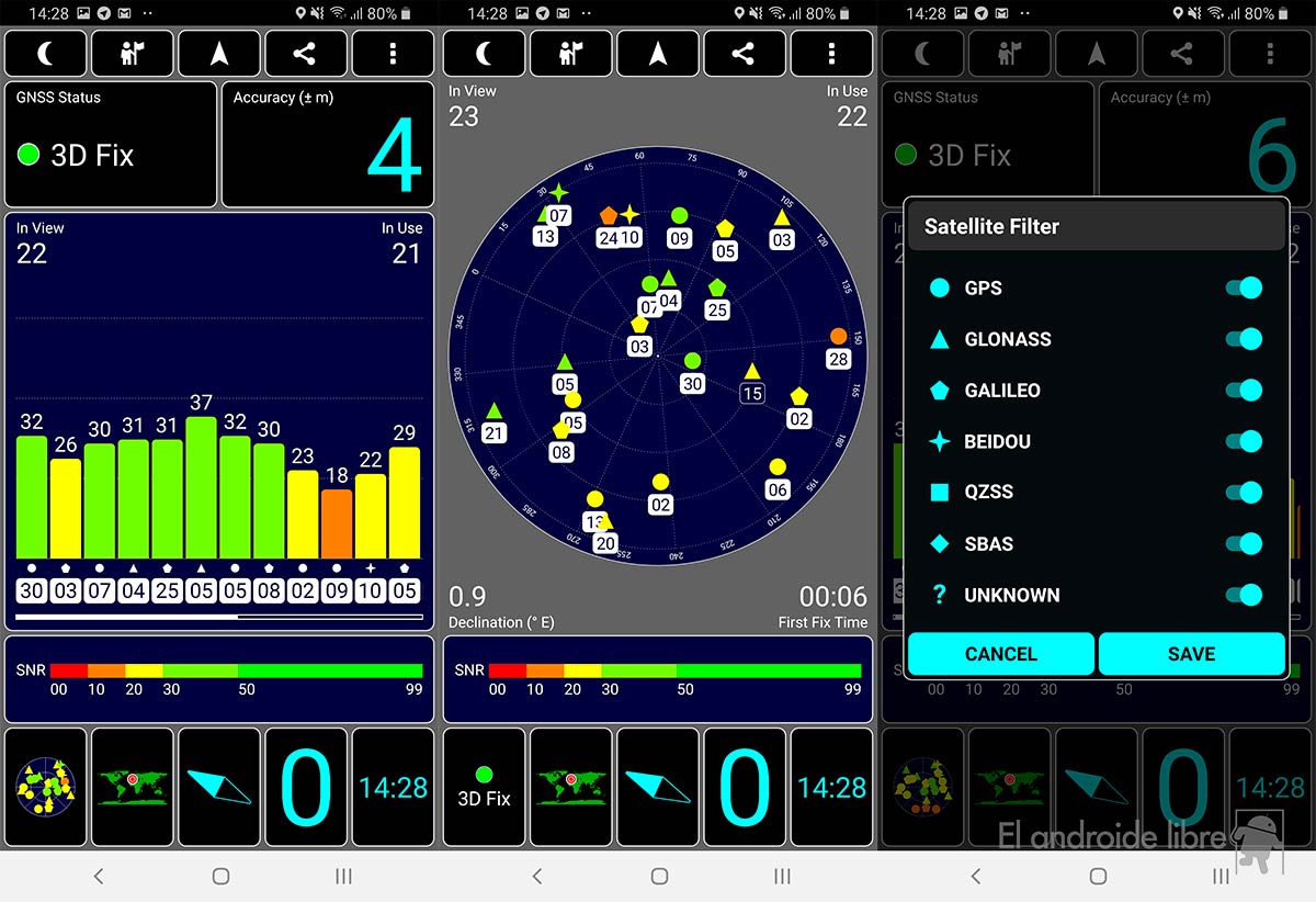
Although they seem the same by name, this application has nothing to do with the previous one even though it does reflect the same use:dentify the information of the different satellites. GPS Test is an app with a hearth in Android and has not changed its appearance in years (maybe its worst, its outdated interface). Of course, it shows almost everything you need to know about the satellites that "grab" your smartphone. IDs, system to which they belong, identifies the signal strength, places the satellites in the sky thanks to their aerial view … GPS Test is a spectacular application.
You can opt for two different versions: one free and with ads and another full and full of options. At the basic level both are equal, you decide.
